KLETTERSTEIG IN THE TYROL
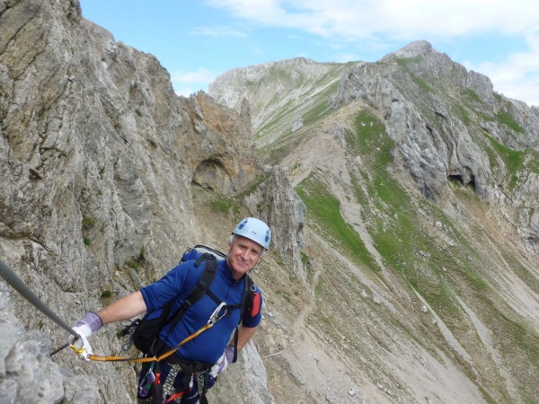
The suncream came out in the afternoon heat at Munich Airport, where I met York MC's longest serving expat., Jack Pezzey, now an Australian. However by early evening the Tyrol was resounding to Gotterdammerung as the thunderstorm boomed and cracked and the rain came down in streams. Jack and I had found just 5 days between mutual commitments during his European tour.
We had to dodge the wrath of the Gods (at one point up the mountain in the LamsjochHutte there came an instruction to keep all windows shut and not to touch any taps in the toilets !).
During the non-thunderstorm bits, we were able to climb three "Klettersteig' routes on different days. You could say it's German (or Austrian) for "via ferrata", although there are some differences in character. (There's also very little current information in English..........). We were concentrating on the Karwendel range, which is part of the Northern Limestone Alps, north of Innsbruck.
BRUNNSTEIN.
A smaller mountain on a misty day. Nevertheless it towers over the Inn valley and has a substantial limestone cliff defending the tiny summit ridge all around. A pleasant hour and a quarter walk through woods to the Brunnsteinhaus Hut. The route goes up from there.
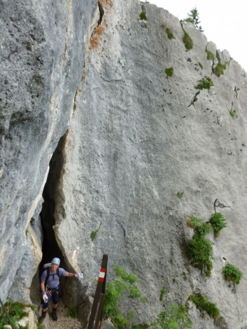
Initially there is an amusing natural cleft in the rock, then follow the wires easily up various ledges and paths. At the odd steeper bit there are a few steel rungs in the rock, or stemples (single steel bars to stand on, projecting from the rock).
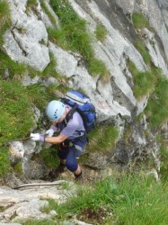
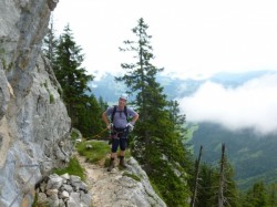
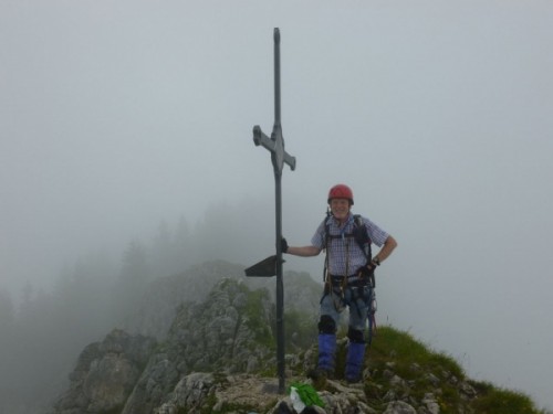
There is 1000 feet of this, going up to the summit. (We made it 2000 feet by coming down the same way). The overall "feel" of this is akin to clambering up Jack's Rake, although whilst I've done Jack's in steady rain, I felt the steel cable was helpful on steep wet limestone. The summit holds a cross, (with gipfelbuch which we duly completed) and a tiny chapel. Mostly, however, the summit ridge is only a metre or so wide. Back at the Brunnsteinhaus we had a well-deserved bier vom fass, before our walk down, and hoped for better weather on the morrow.
MITTENWALDER KLETTERSTEIG

This is a high ridge route, some 5.5 kilometres long, across several jagged summits which form the western outpost of the Karwendel. To quote
"The Mittenwalder Klettersteig is a spectacular scramble following a knife sharp ridge high above the town of Mittenwald. It offers incredible views into the valley of the river Isar to the west and the legendary Karwendeltal (Karwendel Valley) to the east. The ridge’s elevation is in average about 1400 meters / 4600 feet above the riverbed. The ridge as well forms the borderline between Austria (Tyrol) and Germany (Bavaria) From the ridge the climber enjoys also spectacular views into the Karwendel Range and Wetterstein Range. On clear days the Ötztal and Stubai Alps are stretching along the horizon."
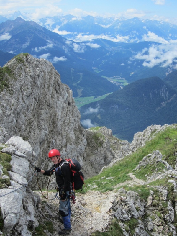
Halfway through a poor morning, but with hope in our hearts, we took the cable car from Mittenwald (about 900 metres) and zoomed up the height of Ben Nevis to the top tourist station at 2244 metres.
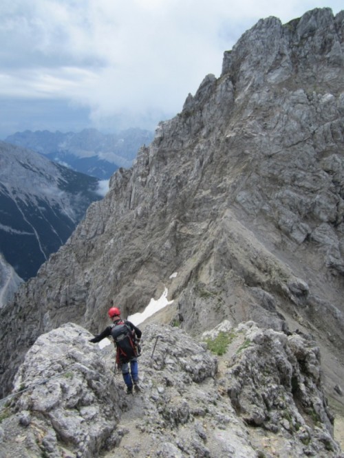
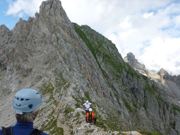
From here it's 15 minutes to the first wires, clip on, and off we go to the Nordlische Linderspitze at 2372 metres. The route leads on over a succession of rocky mountain summits round about 2300 metres, linked by narrow cols, for the next three-and a half miles.
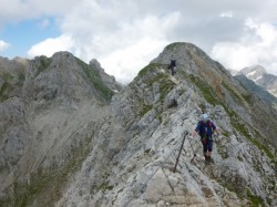
The atmosphere is very similar to Skye Main Ridge, in terms of the narrowness, mainly composed of bare rock, and the constant clambering mile after mile. Yet no route-finding issues...... just follow the steel cable. However an unaided traverse would be very substantially harder than Skye, as there are about 5 major vertical sections, and sundry other awkward traverses with horrific drops. Being Klettersteig, however, there is this friendly cable which you can ignore, hold on to, clip on to, or double clip according to taste.
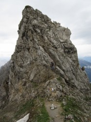
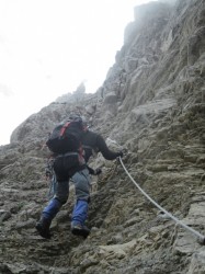
The vertical sections are of course surmounted with fixed ladders. And naturally, rock steps are equipped with steel rungs or projecting stemples.
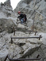
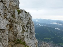
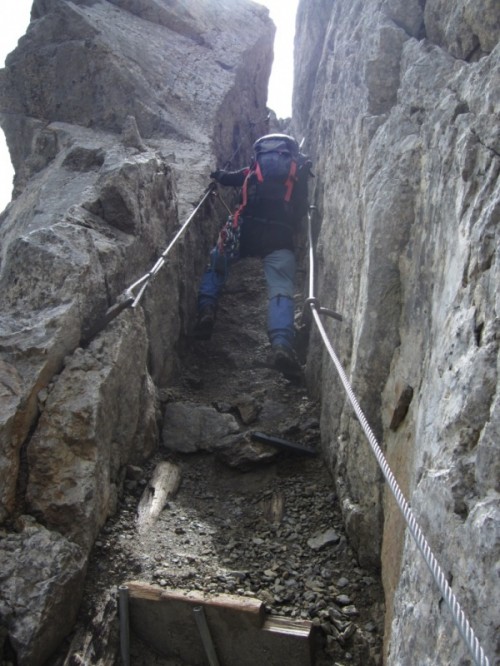
In fact at one spot, the route traverses the dizzying east flank of Sulzeklammspitze almost with the intent, one thinks, of taking in a steep natural chimney. Here, each side of the chimney sports stemples for the left foot and right foot alternately, as well as cables either side. !!
The generous protection enabled us to make steady and rapid progress along the ridge, and the wire is ALMOST continuous, except for the odd short walk across an easy col. Except that, after one such place, the resumption of the wire only came on the far side of an old snow gulley. The snow was only a few metres across, but offered 4000 feet of exposure as it swept down into the Karwendel valley. Out with the ice axe. Gently, gently, across.
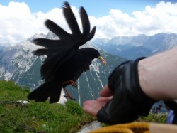
We crossed the high Klettersteig section itself in about 20 minutes less than the book time of 3 hours, and after a knife-edge finale, we settled down to lunch with some attractive birds.
The afternoon got seriously warm, but it was no cake-walk, as there was 1400 metres of fairly steep descent path to be managed. Happily, a mountain hut halfway down provided a beer and a rest stop.
The Mittelwander is a very secure route, with sensational views and lots of places to enjoy them. Generally there are no real technical difficulties, although we had the 'out-of-character" exposure at the snow gulley, and early season snow would be more of a problem.
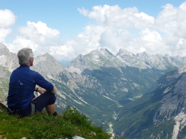
HAIDACHSTELLWAND KLETTERSTEIG
Over at the east side of the range, we took the cable car from the valley of the Achensee to Erfurterhutte. This gives access to a large cirque of mountains, all 5 of which are traversed and connected by klettersteig. About an hour and a couple of km across a rocky limestone hanging valley took us up to the Krahnsattel pass, and the gearing up spot.
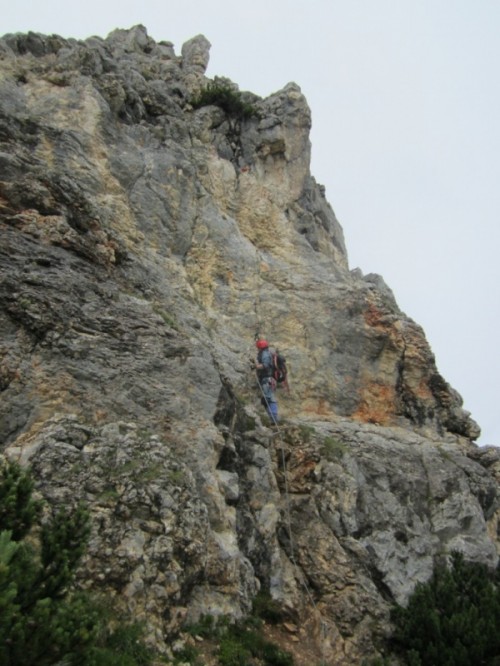
The Haidachstellwand (2192m) is a ridge about 1km long. The route climbs the steep northern end, and it is a recently-built route with a much more "sporty"feel than Mittenwald. The route climbs 600 feet altogether, from the saddle to the summit.
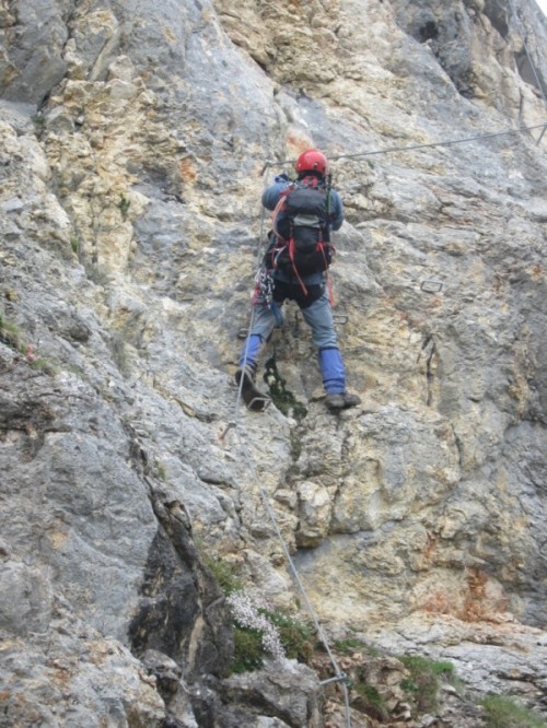
Much of this is very steep, at occasional places vertical and maybe slightly overhanging. The effort involved feels like climbing a similar 600 feet at "V.Diff / Severe", although as we were moving a lot faster than roped climbing , of course with no stops for belaying, there was more of a 'pumped' feeling. The local Topo describes the route as having sections graded A, B, and C. (on a scale going to E)
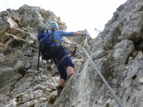
This sportier style of route, required quite a lot more use of rock hand and foot-holds, also hand over hand hauling up the wires. There are no ladders, rungs, or stemples, and the steep parts have small individual metal footsteps the size of a boot sole.
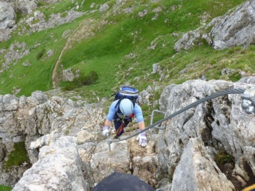
Both of us were carefully using full klettersteig techniques here:- clipping both krabs, and when the going got vertical, I would reach up and clip a wire foot loop overhead, to cut out the possibility of a 4 metre fall down the wire to the previous clamp.
(Obviously a total fall of 5 metres onto a one-metre lanyard would produce a fall factor of 5 in such a case. Remembering that the normal maximum fall factor in roped climbing is 2, it seemed a good idea to avoid much bigger numbers.............)
Towards the upper end, I saw the wire ahead suddenly shoot off rightwards. Pulling over the next rocks....... "ah!, yes, its a wire bridge." One wire for the feet and one for the hands crossed a very deep gap between two pinnacles. Very Scouting, I thought.
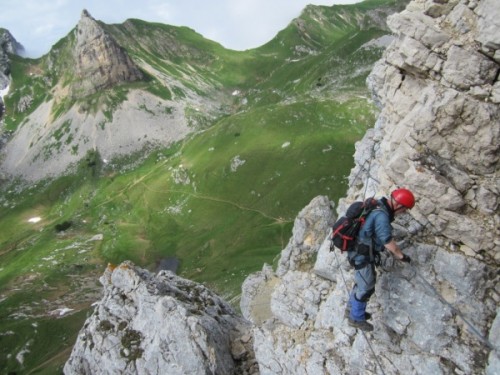
In the hot afternoon, we got on to the grassy summit and signed the gipfelbuch with some sense of merit.
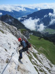
The crossing of the Haidachstellwand is completed by finding a cable at the south end, which is the key to a delightful falling traverse of the last 150 foot cliff. We lingered a little over this excellent finish, as it was also the end of our few short days in the Karwendel.

It's amazing that the only English guidebook to Klettersteig is now out-of-print, and has not been revised since 1983. A beer at the Erfurterhutte was followed by a good evening meal, and some speculation whether we could get a commission from Cicerone to investigate a couple of dozen more of these routes which are plentiful throughout the German and Austrian Alps.
ANDREW
Here's an addendum with information, as it is curiously hard to come by. (in English)
The one and only Guide Book in English (it would seem) is the Cicerone "Klettersteig" Guide by Paul Werner. This is a 1987 translation from a 1983 text and is now out of print.
I used this book for the Hindelanger Klettersteig and the Zugspitze in 1999, but it is now incorrect in various places, as routes have changed. (In particular as regards the Seegrube and adjacent Innsbrucker Klettersteig).
There is a very useful video of the Mittelwalder Klettersteig at http://www.youtube.com/watch?v=64bGTAb84mg
plus a detailed account in English at http://www.summitpost.org/mittenwalder-klettersteig/182680
The Achensee Tourist Office gives out a free leaflet about climbing in the area, which includes a topo for the 5 summits in the cirque. This info is also at http://achensee.info/aktivurlaub/sommerurlaub/kletterurlaub/klettersteige
together with some other routes including the Brundertunnel.
I also found (but did not have time to use)
http://www.tyrol.tl/en/sport-offers/climbing-and-mountaineering/
http://www.summitpost.org/goetheweg-trail/302130
